Appearance
Unearthing the Past: GIS Heritage Management in the Digital Age 🗺️✨
History whispers through data, if you know how to listen. In the realm of cultural heritage, that data is increasingly spatial, and the tool for listening is Geographic Information Systems, or GIS. For centuries, preserving our past has been a delicate dance between meticulous documentation and hands-on conservation. Today, GIS heritage management is revolutionizing this dance, bringing unprecedented precision and powerful insights to the challenge of safeguarding our shared human story.
What is GIS in Heritage Management?
At its core, GIS allows us to capture, store, analyze, and present all types of geographical data. When applied to cultural heritage, it becomes an invaluable platform for:
- Mapping and documenting archaeological sites, historical buildings, and cultural landscapes.
- Analyzing spatial relationships between artifacts, features, and environmental factors.
- Monitoring changes over time, such as erosion, development, or climate impact on heritage sites.
- Managing conservation efforts, resource allocation, and visitor access.
- Visualizing historical data in engaging and accessible ways.
It’s about understanding "where" and "why" things are located, and how those locations influence their preservation and significance. This capability is absolutely crucial for effective heritage asset management.
Why is GIS a Game-Changer for Cultural Heritage Conservation?
Traditional methods often involve paper maps, physical records, and manual surveys. While valuable, these can be time-consuming, prone to error, and difficult to update or share comprehensively. GIS offers a digital, dynamic, and integrated approach.
- Precision and Accuracy: Digital mapping reduces human error and allows for highly accurate measurements and spatial analysis.
- Data Integration: It brings together diverse datasets – from excavation records to climate data, land use, and architectural plans – into a single, cohesive system.
- Predictive Analysis: By understanding patterns, GIS can help predict risks like natural disasters or urban encroachment on heritage sites.
- Enhanced Visualization: Complex spatial information can be presented in intuitive maps, 3D models, and interactive dashboards, making it easier for experts and the public to understand.
- Collaborative Power: A centralized GIS database allows multiple stakeholders – archaeologists, urban planners, government agencies, and local communities – to work with the same, up-to-date information.
Emerging Trends in GIS Heritage Management
The field is constantly evolving, with exciting new trends shaping how we preserve and interpret the past. Here are some key areas where GIS is making significant strides:
1. 3D Mapping and Virtual Reconstruction
Gone are the days of flat, two-dimensional representations alone. Modern GIS integrates seamlessly with 3D modeling technologies like photogrammetry and LiDAR (Light Detection and Ranging).
- Photogrammetry: Using a series of overlapping photographs, software can create detailed 3D models of artifacts, buildings, or entire sites. These models can then be geo-referenced within a GIS environment.
- LiDAR: This remote sensing technology uses pulsed laser light to measure distances, creating highly accurate 3D point clouds. LiDAR is invaluable for mapping obscured features under dense vegetation or for creating precise digital elevation models of archaeological landscapes.
Combining these with GIS allows for:
- Virtual Excavations: Explore a site digitally, even before or after physical excavation.
- Reconstruction of Lost Structures: Recreate how ancient buildings or landscapes might have looked, providing immersive educational experiences.
- Detailed Damage Assessment: Document and monitor structural integrity of heritage buildings in 3D.
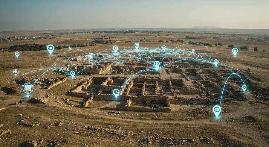
Here's a conceptual visualization of how diverse data layers can be integrated in a GIS for heritage studies:
2. Risk Assessment and Predictive Modeling
Climate change, natural disasters, and uncontrolled urban development pose significant threats to cultural heritage. GIS is a powerful tool for identifying vulnerabilities and planning mitigation strategies.
- Hazard Mapping: Overlaying flood plains, seismic zones, or erosion patterns with heritage site locations to assess risk.
- Vulnerability Assessment: Combining data on building materials, structural conditions, and historical events to understand susceptibility to damage.
- Predictive Scenarios: Modeling the potential impact of future events (e.g., sea-level rise, increased tourism) on heritage sites.
This allows heritage management professionals to prioritize conservation efforts and allocate resources effectively, preventing irreversible loss.
3. Participatory GIS and Community Engagement
Heritage asset management isn't just about expert intervention; it's increasingly about involving local communities. Participatory GIS empowers local populations to contribute their knowledge, identify important sites, and engage in conservation planning.
- Crowdsourcing Data: Communities can use simple mobile apps to collect and contribute geo-tagged information about local heritage.
- Interactive Maps: Providing accessible online GIS maps where communities can explore heritage assets, add comments, or report issues.
- Informed Decision-Making: Ensuring that conservation plans reflect local values and traditional knowledge.
This approach fosters a sense of ownership and responsibility, leading to more sustainable and equitable heritage conservation.
4. Integration with Building Information Modeling (BIM)
For standing structures, particularly historical buildings, the integration of GIS with Building Information Modeling (BIM) is a rapidly growing trend.
- BIM focuses on detailed 3D models of buildings with rich attribute data about materials, construction phases, and structural components.
- GIS provides the broader spatial context – the building's location within a city, its relationship to surrounding heritage zones, and environmental factors.
The synergy between BIM and GIS creates a comprehensive digital twin of a heritage building, from its intricate architectural details to its wider urban and historical context. This facilitates more holistic heritage conservation and planning.
5. Semantic Web and Linked Open Data for Heritage
Connecting GIS data with the Semantic Web and Linked Open Data (LOD) initiatives is enhancing the discoverability and interoperability of heritage information.
- Semantic GIS: Adding meaning and relationships to spatial data, allowing for more intelligent queries (e.g., "Show me all Roman villas near a river built before 200 AD that are currently at risk of flooding").
- Linked Open Data: Publishing heritage data in a standardized, interlinked format makes it machine-readable and discoverable across different databases worldwide.
This creates a vast, interconnected web of heritage information, fostering new research opportunities and public engagement.
Examples in Action: GIS Safeguarding Our Past
Numerous projects worldwide are demonstrating the power of GIS in action.
- Mapping Archaeological Landscapes: In many regions, GIS is used to identify potential archaeological sites from aerial imagery and historical maps, guiding future excavations and protecting unknown heritage areas from development.
- Urban Heritage Management: Cities like Rome or Kyoto use GIS to manage their vast historical centers, tracking renovations, enforcing preservation guidelines, and planning tourist flows.
- Monitoring World Heritage Sites: Organizations like UNESCO leverage GIS to monitor the condition of World Heritage Sites, assessing threats and tracking conservation efforts from a global perspective.
- Post-Disaster Assessment: After earthquakes or conflicts, GIS quickly helps assess damage to cultural heritage, prioritize rescue efforts, and plan reconstruction.
The Future of GIS Heritage Management
The journey continues. The future of GIS heritage management promises even deeper integration with Artificial Intelligence (AI) for automated feature detection, advanced machine learning for predictive analytics, and increasingly immersive Virtual and Augmented Reality (VR/AR) experiences for public engagement.
The goal remains the same: to listen to the whispers of history, unearthing insights one algorithm at a time, and ensuring that our rich cultural legacy endures for generations to come. Digital heritage preservation is not just about technology; it's about connecting with our shared past in new and profound ways.
References & Further Reading
- Emerging trends in GIS application on cultural heritage conservation: a review: https://www.nature.com/articles/s40494-024-01265-7
- The Role of Geographic Information Systems (GIS) in Participatory Conservation of Heritage Areas: https://eurogeojournal.eu/index.php/egj/article/view/657
- Use of GIS Tools in Sustainable Heritage Management—The Example of the “Central Route of Cycling Heritage”: https://www.mdpi.com/2071-1050/11/20/5616